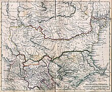
Файл:Post Roman Balkans.jpg

Розмір при попередньому перегляді: 729 × 600 пікселів. Інші роздільності: 292 × 240 пікселів | 583 × 480 пікселів | 933 × 768 пікселів | 1245 × 1024 пікселів | 2038 × 1677 пікселів.
Повна роздільність (2038 × 1677 пікселів, розмір файлу: 721 КБ, MIME-тип: image/jpeg)
Історія файлу
Клацніть на дату/час, щоб переглянути, як тоді виглядав файл.
| Дата/час | Мініатюра | Розмір об'єкта | Користувач | Коментар | |
|---|---|---|---|---|---|
| поточний | 18:49, 28 січня 2010 |  | 2038 × 1677 (721 КБ) | WikiEditor2004 | Reverted to version as of 01:28, 27 March 2005 - restored original version which has more historical value. please upload your whitened version as a new separate file, not over this one, thank you |
| 10:02, 17 травня 2009 |  | 2038 × 1677 (1,1 МБ) | Alex:D | whitened | |
| 01:28, 27 березня 2005 |  | 2038 × 1677 (721 КБ) | Karmosin~commonswiki | Classical Balkans: from ''Map from "rothers Publishers, New York, 1849A Classical Atlas to Illustrate Ancient Geography,'' Alexander G. Findlay, Harper and B ros. NY 1849 {{PD-art}} category:History of the Balkans |
Використання файлу
Такі сторінки використовують цей файл:
Глобальне використання файлу
Цей файл використовують такі інші вікі:
- Використання в ar.wiki.x.io
- Використання в arz.wiki.x.io
- Використання в azb.wiki.x.io
- Використання в az.wiki.x.io
- Використання в ba.wiki.x.io
- Використання в be-tarask.wiki.x.io
- Використання в be.wiki.x.io
- Використання в bg.wiki.x.io
- Використання в ca.wiki.x.io
- Використання в cs.wiki.x.io
- Використання в en.wiki.x.io
- Використання в eo.wiki.x.io
- Використання в es.wiki.x.io
- Використання в gl.wiki.x.io
- Використання в he.wiki.x.io
- Використання в hr.wiki.x.io
- Використання в hy.wiki.x.io
- Використання в it.wiki.x.io
- Використання в ja.wiki.x.io
- Використання в mk.wiki.x.io
- Використання в nl.wiki.x.io
- Використання в pt.wiki.x.io
- Використання в ro.wiki.x.io
- Використання в ru.wiki.x.io
Переглянути сторінку глобального використання цього файлу.


