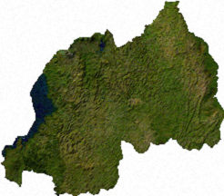
Файл:Rwanda sat.png
Rwanda_sat.png (246 × 216 пікселів, розмір файлу: 84 КБ, MIME-тип: image/png)
Історія файлу
Клацніть на дату/час, щоб переглянути, як тоді виглядав файл.
| Дата/час | Мініатюра | Розмір об'єкта | Користувач | Коментар | |
|---|---|---|---|---|---|
| поточний | 02:44, 14 липня 2006 |  | 246 × 216 (84 КБ) | Unquietwiki | ECW to TIFF to PNG (compression level 9). {{PD-MapLibrary}} |
Використання файлу
Така сторінка використовує цей файл:
Глобальне використання файлу
Цей файл використовують такі інші вікі:
- Використання в ar.wiki.x.io
- Використання в en.wiki.x.io
- Використання в fo.wiki.x.io
- Використання в it.wiki.x.io
- Використання в ja.wiki.x.io
- Використання в mk.wiki.x.io
- Використання в ms.wiki.x.io
- Використання в ru.wiki.x.io
- Використання в rw.wiki.x.io
- Використання в vi.wiki.x.io

