Файл:Vanuatu archipelago hit by Cyclone Lola (Copernicus).jpg
Повна роздільність (4001 × 4061 пікселів, розмір файлу: 3,06 МБ, MIME-тип: image/jpeg)
| Відомості про цей файл містяться на Вікісховищі — централізованому сховищі вільних файлів мультимедіа для використання в проектах Фонду Вікімедіа. |
.jpg)
Опис файлу
| Опис |
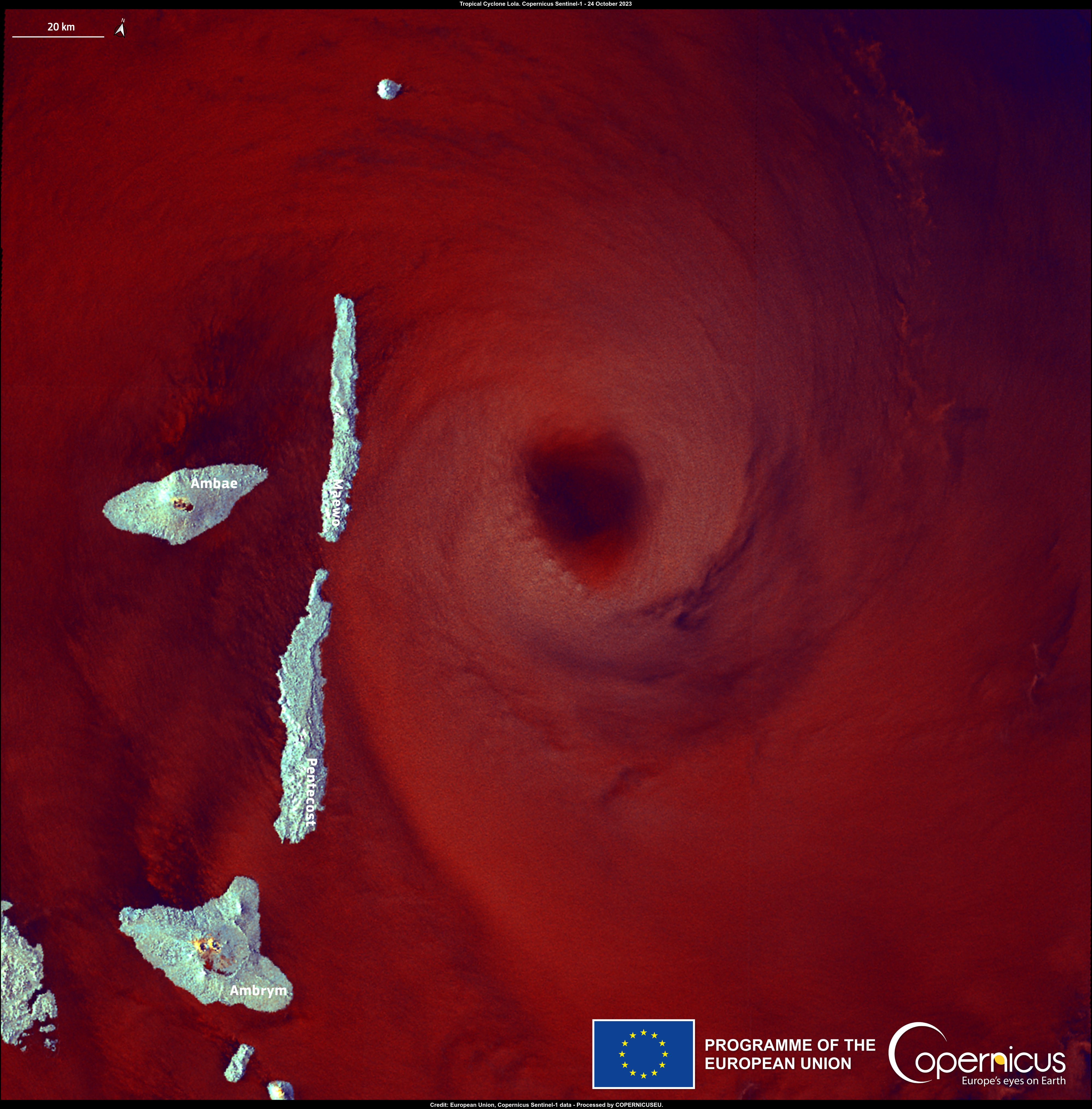
English: Tropical Cyclone Lola made landfall in Vanuatu, in the South Pacific, between 24 and 25 October, bringing heavy rainfall, strong winds and storm surges across the archipelago. Lola interrupted communications and caused widespread damage to homes and crops in the northern and central provinces of the country. This Copernicus Sentinel-1 radar image of Cyclone Lola, acquired on 24 October, shows the eye of Lola east of Maewo Island. The Rapid Mapping module of the Copernicus Emergency Monitoring Service (CEMS) has been activated to monitor the impact of Lola in 12 areas of interest and to provide emergency mapping for damage assessment. More information is available here: EMSR702 |
| Час створення | Сфотографовано 24 жовтня 2023 |
| Джерело | Vanuatu archipelago hit by Cyclone Lola |
| Автор | European Union, Copernicus Sentinel-1 imagery |
Ліцензування

|
This image contains data from a satellite in the Copernicus Programme, such as Sentinel-1, Sentinel-2 or Sentinel-3. Attribution is required when using this image.
Зазначення авторства: Contains modified Copernicus Sentinel data 2023
The use of Copernicus Sentinel Data is regulated under EU law (Commission Delegated Regulation (EU) No 1159/2013 and Regulation (EU) No 377/2014). Relevant excerpts:
Free access shall be given to GMES dedicated data [...] made available through GMES dissemination platforms [...].
Access to GMES dedicated data [...] shall be given for the purpose of the following use in so far as it is lawful:
GMES dedicated data [...] may be used worldwide without limitations in time.
GMES dedicated data and GMES service information are provided to users without any express or implied warranty, including as regards quality and suitability for any purpose. |
Історія файлу
Клацніть на дату/час, щоб переглянути, як тоді виглядав файл.
| Дата/час | Мініатюра | Розмір об'єкта | Користувач | Коментар | |
|---|---|---|---|---|---|
| поточний | 12:05, 27 жовтня 2023 | | 4001 × 4061 (3,06 МБ) | OptimusPrimeBot | #Spacemedia - Upload of https://www.copernicus.eu/system/files/2023-10/image_day/20231026_CycloneLola.jpg via Commons:Spacemedia |
Використання файлу
Така сторінка використовує цей файл:
Глобальне використання файлу
Цей файл використовують такі інші вікі:
- Використання в en.wiki.x.io
- Використання в zh.wiki.x.io
.jpg)